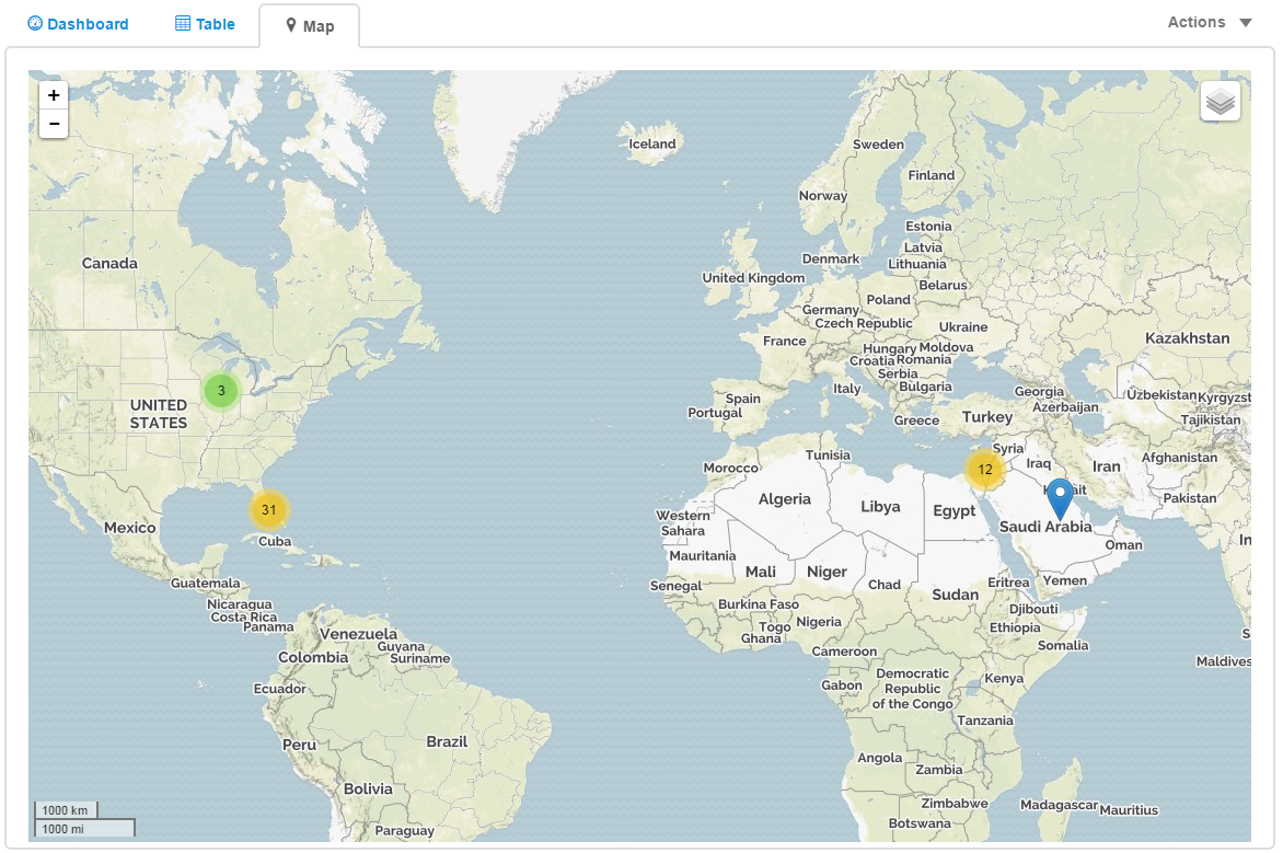
The Map tab displays the locations of the cellular devices.
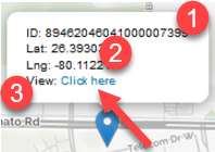
Clicking an current location
icon will display:
- The cellular device's ID
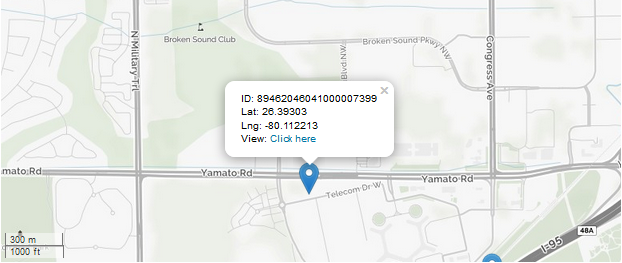
- The latitude and longitude of the cellular device.
- To view details, click on Click
here to view the
details of the connection.
The colored circles with a number in them are marker clusters. These clusters are based on each pins reported location and it's proximity to other pins scaled by the map zoom level. The color is a default at-a-glance indication of the cluster size. The default colors are a shade of green, yellow, and red. The boundary's between colors are the marker counts 10 and 100.
- Cluster counts under 10 are green.
- Cluster counts over 100 are red.
- Cluster counts between 10 and 100 are yellow.
As you zoom into larger clusters they will get separated into smaller clusters until the max zoom limit is reached. At that point clicking on the marker cluster will spider out the remaining pins around a central point.
Related topics